Bukhansan Seoul: 13 Official Trails, Peak at 835.6 m
All 13 official trails of Bukhansan National Park (Seoul District) by time and difficulty, plus the highest peak Baegundae at 835.6 m, five car parks within 530 m of the ranger stations, nearby emergency rooms, 373 licensed lodgings and campsites.
Data as of 2026-10-13
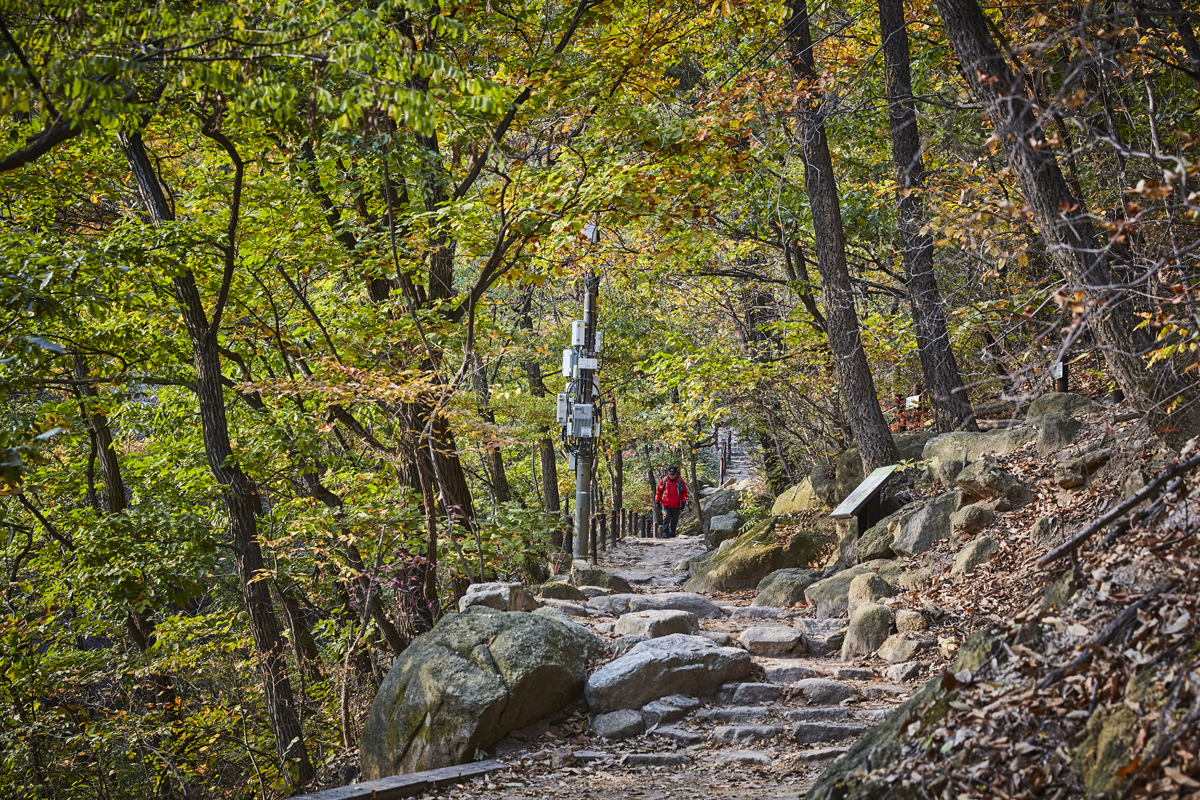
Bukhansan National Park (Seoul District) is reached from the Ui-dong area of Gangbuk-gu, Seoul. Its highest peak, Baegundae (백운대), rises to 835.6 m. The Korea Tourism Organization describes it as the guardian mountain of Seoul, and it was known as Samgaksan in the early Joseon period. It became a national park in 1983. The Korea National Park Service lists 13 official trails, rated 8 easy and 5 moderate. They take between 1 hour and 3 hours 30 minutes, so it helps to pick your entrance and trail before you set off.
The name and the fortress
An old geography text, the Sinjeung Dongguk Yeoji Seungnam, says the name Samgaksan (Three Horn Mountain) comes from three peaks: Baegundae, Insubong and Mangyeongdae. Construction of Bukhansanseong Fortress began in 1711 under King Sukjong and is said to have finished within six months. The wall is 10 km long and had 14 gates, and most of the gates have been restored. The mountain also has many old temples, including Doseonsa, Taegosa, Hwagyesa, Munsusa and Jingwansa.
Trails: all 13 by time
The times are those published by the Korea National Park Service. Allow extra for rest stops, weather and your own pace. The paths are tangled like a web, so keep track of where you are as you walk.
| Trail (Korean name) | Difficulty | Time |
|---|---|---|
| Bibong (비봉코스) | Moderate | 1 h |
| Daedongmun (대동문코스) | Easy | 1 h 10 min |
| Bogukmun (보국문코스) | Easy | 1 h 20 min |
| Ueam Rock (우이암코스) | Easy | 1 h 30 min |
| Baegundae (백운대코스) | Moderate | 1 h 30 min |
| Sinseondae (신선대코스) | Easy | 1 h 40 min |
| Mangwolsa, Podae, Hoeryong (망월사,포대,회룡코스) | Easy | 2 h 20 min |
| Samo Rock (사모바위코스) | Moderate | 2 h 30 min |
| Bukhansanseong Fortress (북한산성코스) | Moderate | 2 h 40 min |
| Daenammun (대남문코스) | Easy | 3 h |
| Sapaesan (사패산코스) | Easy | 3 h |
| Sogwicheon (소귀천코스) | Moderate | 3 h 10 min |
| Obong (오봉코스) | Easy | 3 h 30 min |
There are six main starting points: Ui-dong, the 4.19 Memorial, Jeongneung, Segeomjeong, Bulgwang-dong and the Gupabal fortress entrance. Park data lists four mountain shelters. Check with the Korea National Park Service whether they are open before you go.
Parking: five car parks within 530 m, two of them free
Korea's national parking registry lists five car parks within 530 metres of the park's ranger stations. Two are recorded as free and the other three charge a fee. A free car park lies within 2 km.
| Car park (Korean name) | Nearest station | Distance | Spaces | Fee (as registered) | Hours |
|---|---|---|---|---|---|
| Howon-dong Wondobong (호원동 원도봉) | Wondobong | 40 m | 47 | Free | 00:00-23:59 |
| Jangheung Herb Theme Park (장흥허브테마공원) | Obong | 340 m | 156 | 600 won per 30 min, then 200 won per 10 min | 09:00-23:59 |
| Dobongsan car park (도봉산 주차장) | Dobong | 420 m | 194 | Free (registered as 0 won) | 00:00-23:39 |
| Dobongsan (도봉산) | Dobong | 420 m | 142 | 170 won per 5 min, then 170 won per 5 min | 08:00-22:00 |
| Songchu 2-gyo underpass public car park (송추2교 하부 공공주차장) | Obong | 530 m | 202 | 600 won per 30 min, then 200 won per 10 min | 09:00-23:59 |
These are registered details and may differ on site. Follow the signs there.
If you need a doctor
The nearest emergency rooms are Daehan Hospital (대한병원, registered emergency room, 1.9 km) and Uijeongbu Hospital of the Gyeonggi Provincial Medical Center (경기도의료원의정부병원, regional emergency medical institution, 2.1 km). Pharmacies are 0.5 to 0.6 km away. Bubu Pharmacy and Sejong Pharmacy are registered as closed on Sundays, while Mannam Onnuri Pharmacy, 0.6 km away, is registered as open. In an emergency, call 119.
Where to stay
There are 373 licensed lodgings within 3 km. Motels and inns are the largest group at 244, followed by 75 residence-type places, 42 hotels, 11 other lodgings and 1 condo or resort. Pensions and farm-stay minbak are registered under a different system and are not counted here. The nearest campsites are Bukhansan Sagimak Campground at 2.3 km, Bukhansan Nongbawi Camping at 2.7 km and Bukhansan Camping at 3.6 km, all general campgrounds. Bukhansan Dulle Camp, a glamping site, is 3.6 km away. Public data also registers 110 toilets.
Distances are straight-line. Opening hours and fees can change, so check again before you travel. Emergency 119 · Coast Guard 122
- Ministry of the Interior and Safety, national parking registry (records dated 2026-03-11 to 2026-10-01)
- National Medical Center, emergency departments (retrieved 2026-10-11)
- National Medical Center, pharmacies (retrieved 2026-10-11)
- Ministry of the Interior and Safety, lodging licences (retrieved 2026-10-11)
- Ministry of Oceans and Fisheries, beach visitor statistics (2015 to 2024, retrieved 2026-10-11)
- Ministry of the Interior and Safety, public toilets (retrieved 2026-10-10)
- Korea Tourism Organization GoCamping (campsites) (retrieved 2026-10-10)
- Korea Coast Guard station locations (retrieved 2026-10-11)
- Ministry of Oceans and Fisheries, beach water quality tests (2025 season tests, retrieved 2026-10-10)
- Korea Tourism Organization English tourism data (names, addresses) (retrieved 2026-10-10)